Published: August 10, 2025
The Central Weather Administration (CWA) announced on Sunday that it could issue a sea warning for Tropical Storm Podul as early as Tuesday, with the possibility of a land warning later that same day.
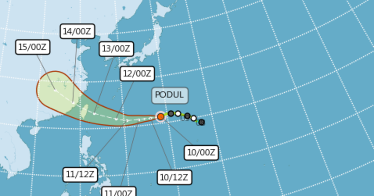
According to CWA forecaster Lin Ding-yi (林定宜), current models indicate that Podul will come closest to Taiwan between August 13 and 14.
As of 8 a.m. Sunday, the storm’s center was located northwest of Guam at 21.4°N, 138.5°E, moving westward at a speed of 19 kilometers per hour. Winds near the center were clocked at a maximum of 30 meters per second.
Lin explained that Podul’s trajectory will be influenced by changes in the Pacific high-pressure system starting Monday. A weakening high would likely steer the storm west-northwest toward the Ryukyu Islands, while a stable or strengthening high could push it directly westward, potentially increasing its intensity.
Meteorologists continue to monitor the storm’s development closely, urging the public to stay alert for updates in the coming days.