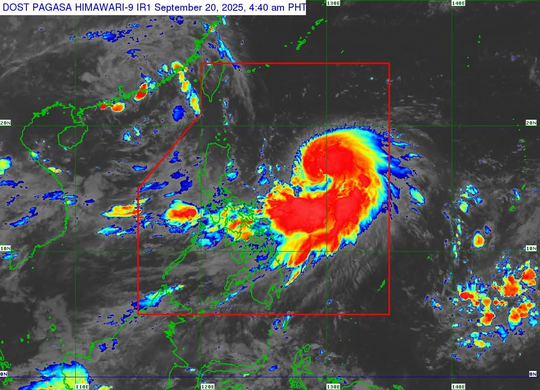
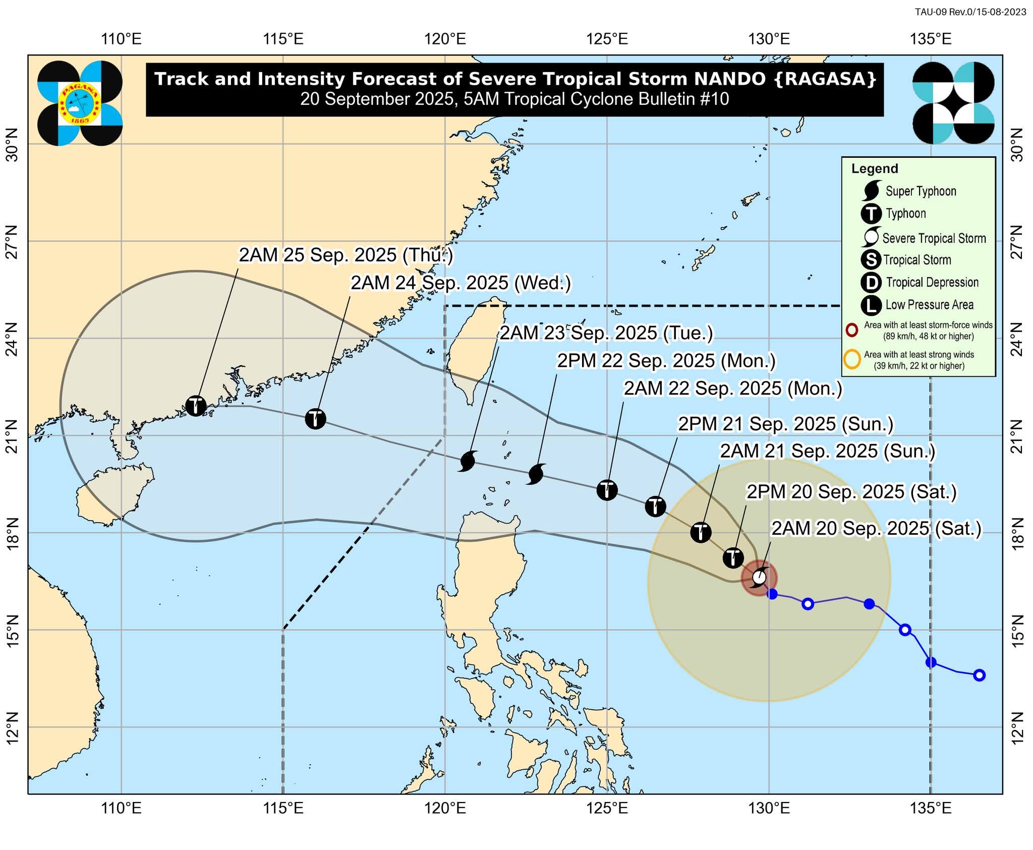
Manila, Philippines – September 20, 2025. Severe Tropical Storm Nando (international name: Ragasa) continues to gain strength as it tracks northwestward over the Philippine Sea, with forecasters warning that it could escalate into a super typhoon before making its closest approach to the country.
As of 4:00 a.m., the center of Nando was located 780 kilometers east of Casiguran, Aurora, carrying maximum sustained winds of 100 kilometers per hour (kph) near the center and gusts of up to 125 kph. The storm is currently moving northwest at 10 kph, with strong to storm-force winds extending outward up to 440 km.
Wind Signals Expected
Although no tropical cyclone wind signals have been raised yet, PAGASA said Signal No. 1 will likely be hoisted over parts of Northern Luzon within the day. Forecasters also cautioned that Nando could intensify into a typhoon within 12 hours and potentially reach Signal No. 5 status as a super typhoon by Monday.
Rainfall and Monsoon Enhancement
The storm is also expected to enhance the southwest monsoon, bringing widespread rains and strong winds across several regions:
-
Today, Sept. 20: Bicol Region, Eastern Visayas, and Caraga
-
Sept. 21: Zambales, Bataan, Tarlac, Pampanga, Bulacan, Metro Manila, CALABARZON, Bicol, MIMAROPA, Visayas, Northern Mindanao, Caraga, Davao Occidental, and Davao Oriental
-
Sept. 22: Central Luzon (non-signal areas), Metro Manila, CALABARZON, Bicol, MIMAROPA, Visayas, Northern Mindanao, Zamboanga Peninsula, BARMM, SOCCSKSARGEN, Davao Occidental, and Davao Oriental
Rough Seas and Possible Storm Surges
Moderate to rough seas, reaching up to 3 meters, are expected over the eastern seaboards of Northern and Eastern Luzon, Bicol, and Northern Samar. PAGASA warned that storm surges may also affect the coastal waters of Northern Luzon starting today.
Forecast Track
Nando is projected to continue moving northwestward before turning west-northwest toward Extreme Northern Luzon. The system may pass close to or make landfall in Batanes or the Babuyan Islands between Monday afternoon and evening. It is expected to exit the Philippine Area of Responsibility (PAR) by Tuesday morning or noon.
Public Advisory
Authorities are urging residents in low-lying and high-risk areas to prepare for possible flooding, landslides, and coastal inundation. The public is advised to monitor official bulletins and heed evacuation orders from local officials as Nando rapidly intensifies.
PAGASA will release the next tropical cyclone bulletin at 11:00 a.m. today.