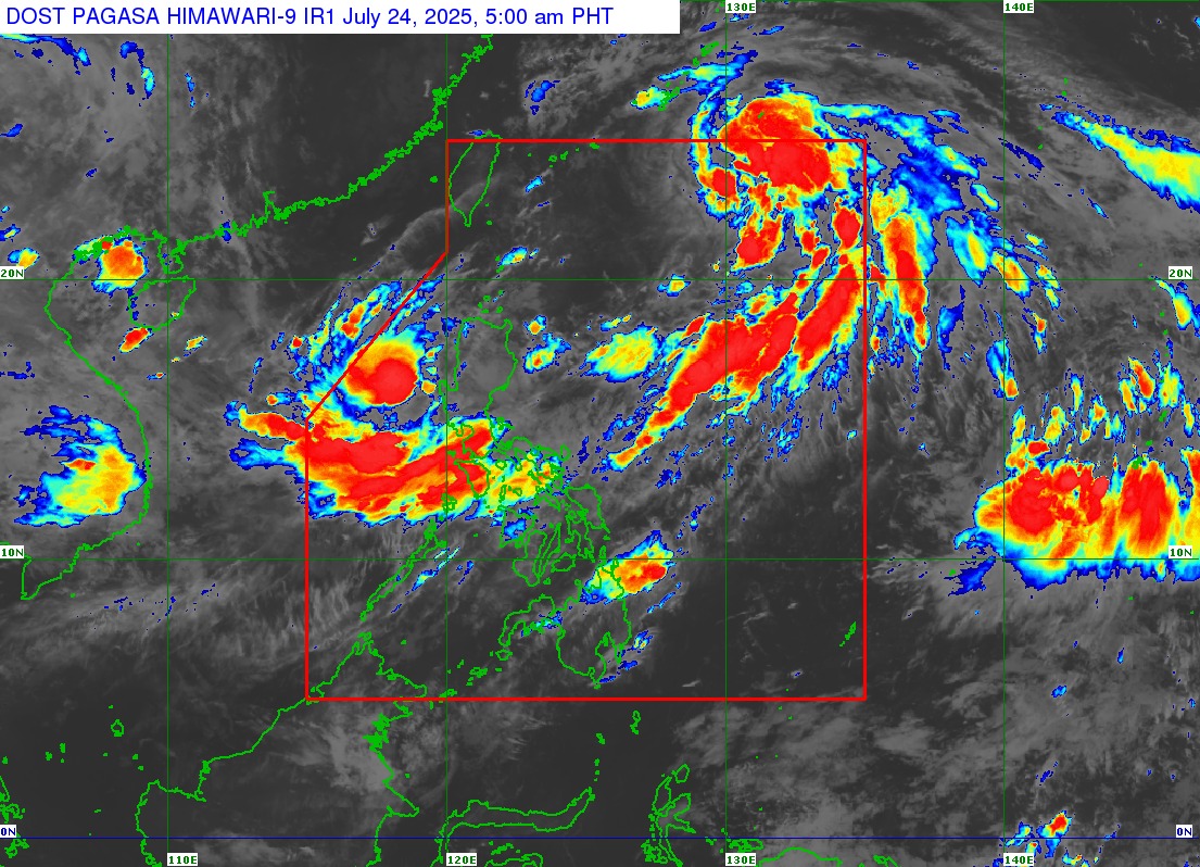
MANILA, Philippines — The Philippine Atmospheric, Geophysical and Astronomical Services Administration (PAGASA) reported early Thursday that Tropical Storm Emong has intensified into a Severe Tropical Storm while moving southwestward over the sea west of the Ilocos Region.
As of 4:00 AM today, the center of Emong was located approximately 245 kilometers west of Bacnotan, La Union (16.6°N, 118.1°E), packing maximum sustained winds of 110 km/h and gusts reaching up to 135 km/h. It is moving at 25 km/h toward the southwest.
Wind Signals Raised
PAGASA has raised Tropical Cyclone Wind Signals (TCWS) across several provinces:
-
TCWS No. 3 (Storm-force winds): Northern Pangasinan (Anda, Bolinao, Bani) and western La Union, including San Fernando City.
-
TCWS No. 2 (Gale-force winds): Covers Ilocos Norte, Ilocos Sur, Abra, Benguet, Mountain Province, parts of Nueva Vizcaya, and central Pangasinan.
-
TCWS No. 1 (Strong winds): Extended to Batanes, Babuyan Islands, Isabela, Nueva Ecija, Tarlac, and other parts of northern and central Luzon.
According to PAGASA, the highest possible warning signal that may be raised during Emong’s passage is Signal No. 4.
Heavy Rains and Enhanced Habagat
The enhanced Southwest Monsoon (Habagat), further intensified by both Severe Tropical Storm Emong and the earlier Tropical Depression Dante, will bring widespread rains and strong gusts across Metro Manila, Central Luzon, CALABARZON, MIMAROPA, Bicol Region, Visayas, and parts of Mindanao until Saturday (July 26).
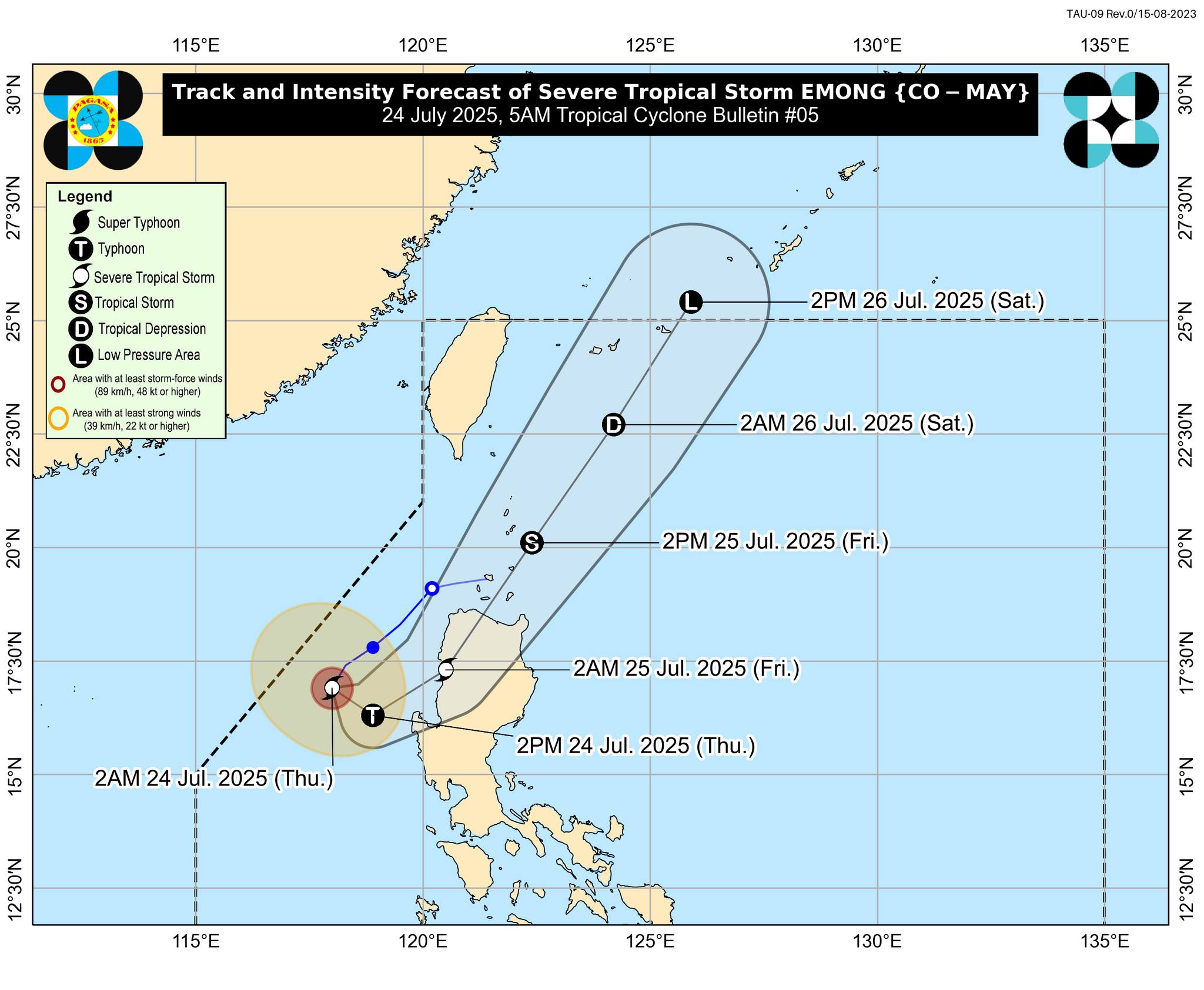
Possible Landfall and Track Forecast
Emong is projected to move southeastward today before curving north-northeast. Based on the latest track, it may pass close to Pangasinan this afternoon and possibly make landfall over Ilocos Region tonight or early Friday. It is expected to re-emerge over the Luzon Strait, possibly brushing past the Babuyan Islands.
Further intensification into a typhoon is not ruled out before it makes landfall.
Coastal Hazards and Sea Conditions
A Gale Warning remains in effect for the western seaboards of Luzon, where sea waves may reach up to:
-
14.0 meters – Ilocos Sur and La Union
-
11.0 meters – Pangasinan
-
8.0 meters – Zambales
-
6.0 meters – Bataan
Moderate to rough seas are also expected in other areas including Palawan, Batangas, Romblon, and Mindoro, posing dangers to all types of sea vessels. PAGASA urges mariners to stay in port or seek shelter.
Storm Surge Threat
A storm surge warning remains active, with 1.0 to 2.0-meter waves expected over low-lying coastal areas in Batanes, Cagayan, Ilocos Norte, Ilocos Sur, Pangasinan, and Zambales within 48 hours.
Public Advisory
Local government units and disaster risk reduction offices are advised to prepare and initiate pre-emptive evacuations if necessary. Residents in flood- and landslide-prone areas are urged to stay alert, heed official warnings, and monitor updates from PAGASA and their local disaster agencies.
The next tropical cyclone bulletin will be issued at 8:00 AM today.
Stay safe and updated through official sources.
Source: DOST-PAGASA Tropical Cyclone Bulletin #5, July 24, 2025, 5:00 AM
Issued by: Department of Science and Technology – PAGASA
Weather System: Severe Tropical Storm Emong (International name: Co-May)