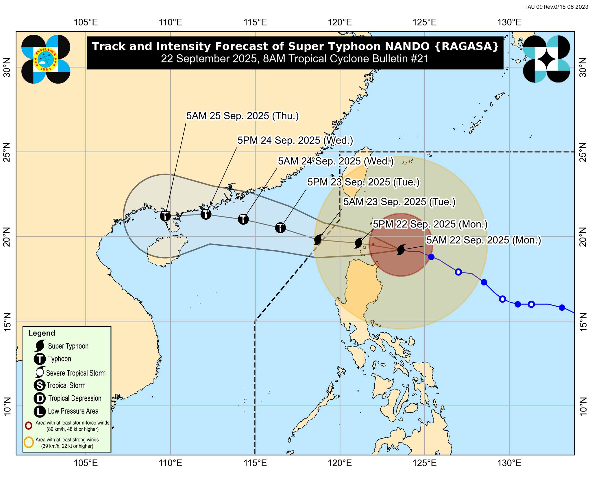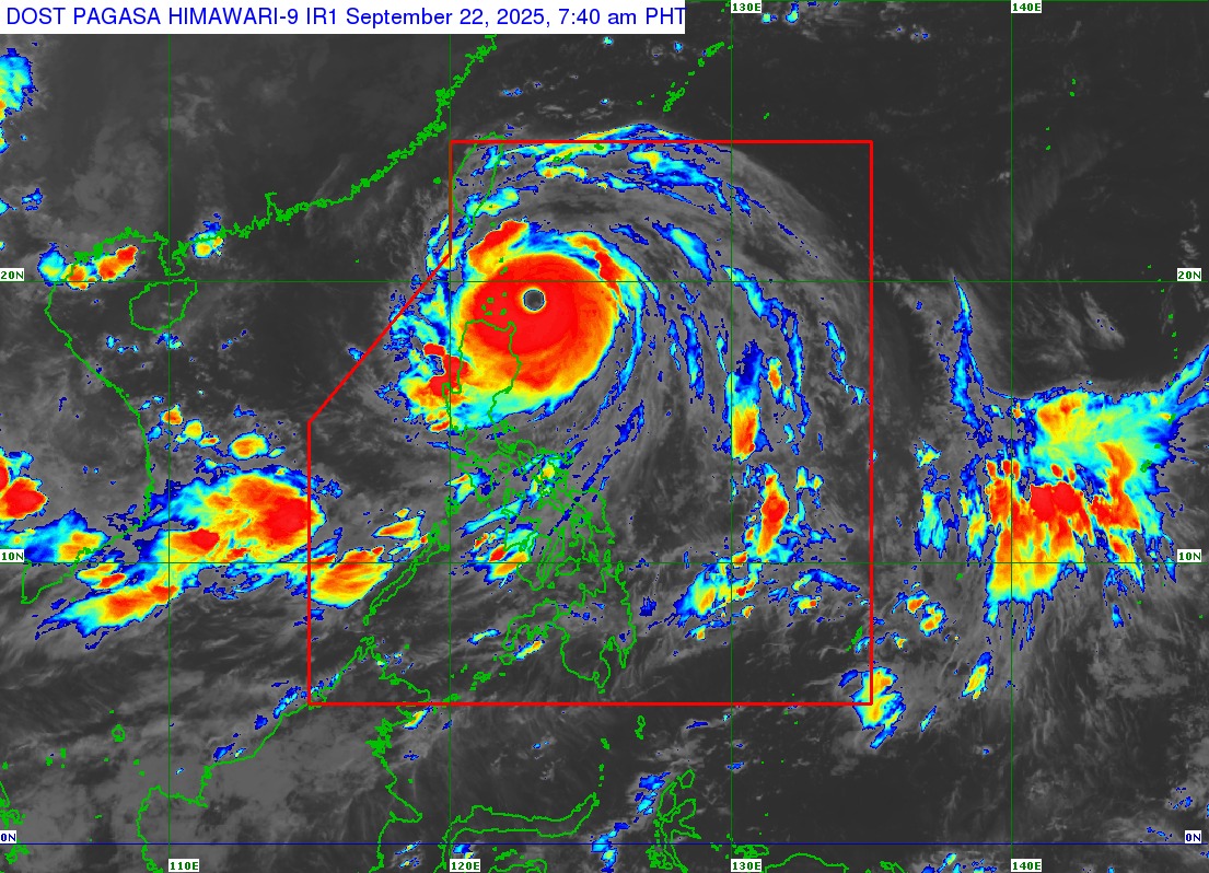
Issued: 8:00 AM, 22 September 2025
MANILA, Philippines – Super Typhoon Nando (international name: Ragasa) further strengthened early Monday as it began shifting westward, placing the Babuyan Islands and nearby areas under extreme threat, according to the Philippine Atmospheric, Geophysical and Astronomical Services Administration (PAGASA).
As of 7:00 a.m., the center of Nando’s eye was estimated at 180 kilometers east of Calayan, Cagayan. The typhoon is packing maximum sustained winds of 215 km/h, gusts of up to 265 km/h, and a central pressure of 910 hPa while moving westward at 20 km/h.
Dangerous Winds and Signal Warnings
The storm’s violent winds extend outward up to 600 kilometers from its center. PAGASA raised the following Tropical Cyclone Wind Signals (TCWS):
-
Signal No. 5 – Northern and central portions of the Babuyan Islands, where Nando poses an extreme threat to life and property.
-
Signal No. 4 – Parts of Batanes, northern Cagayan, and northern Ilocos Norte, facing severe wind damage.
-
Signal No. 3 – Rest of Batanes, central Cagayan, Apayao, and central Ilocos Norte.
-
Signal No. 2 – Isabela, Abra, Kalinga, Mountain Province, Ifugao, Ilocos Sur, northern Benguet, and parts of La Union.
-
Signal No. 1 – Quirino, Nueva Vizcaya, Aurora, Nueva Ecija, Bulacan, Tarlac, Pampanga, Zambales, Pangasinan, northern Quezon including Polillo Islands, and the rest of Benguet and La Union.
PAGASA warned that areas under Signal No. 5 could experience extreme winds and life-threatening conditions within the next 12 hours.
Heavy Rains and Coastal Hazards
Aside from destructive winds, Nando is expected to bring intense rainfall across Northern Luzon, with possible flooding and landslides. The southwest monsoon enhanced by the typhoon will also bring strong winds and rains to Metro Manila, CALABARZON, Central Luzon, Bicol, MIMAROPA, Visayas, and parts of Mindanao.
Coastal communities face life-threatening storm surges exceeding 3 meters in Batanes, Cagayan (including Babuyan Islands), Ilocos Norte, and Ilocos Sur. Seas may reach up to 14 meters around the Batanes-Babuyan area, making sea travel extremely risky.
Track and Outlook
Nando is expected to pass close to or make landfall over the Babuyan Islands between noon and early afternoon today. It is forecast to exit the Philippine Area of Responsibility (PAR) by Tuesday morning, September 23.
PAGASA said Nando may maintain or further strengthen before its close approach to Northern Luzon.
Public Advisory
Disaster management offices are urging residents in high-risk areas to evacuate immediately and follow the guidance of local officials. Those living in coastal and low-lying communities are advised to move to safer ground as storm surges and flooding are expected.
The next PAGASA bulletin will be released at 11:00 AM today.