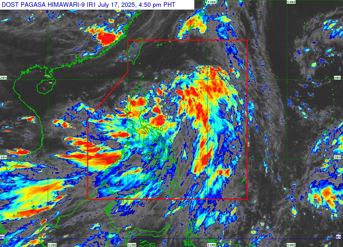
Manila, Philippines – July 17, 2025 — Tropical Depression Crising continues to hold its strength while slowly moving over the Philippine Sea east of Aurora, according to the latest bulletin issued at 5:00 PM today by PAGASA. The system may intensify into a tropical storm within 24 hours and could reach severe tropical storm status by Saturday.
As of 4:00 PM, the center of Crising was estimated at 335 km northeast of Virac, Catanduanes, or about 545 km east of Baler, Aurora. It is packing maximum sustained winds of 55 km/h with gusts of up to 70 km/h and is moving west-northwestward at 30 km/h. The depression’s wind field extends up to 500 kilometers from its center.
Areas Under Tropical Cyclone Wind Signal No. 1
Several parts of Luzon remain under Tropical Cyclone Wind Signal No. 1, indicating the threat of strong winds (39–61 km/h) within 36 hours. These include:
-
Northern and Central Luzon: Batanes, Cagayan (including Babuyan Islands), Isabela, Quirino, northern Nueva Vizcaya, northern Aurora, Abra, Apayao, Kalinga, Mountain Province, Ifugao, and northern Benguet.
-
Ilocos Region: Ilocos Norte, Ilocos Sur, northern La Union.
-
Bicol Region: Polillo Islands, Camarines Norte, and northern Camarines Sur.
-
Eastern Visayas: Catanduanes.
These areas may experience minimal to minor damage, especially in exposed and high-elevation locations.
Heavy Rainfall and Monsoon Enhancement
PAGASA warned of significant rainfall over the next few days, especially as the southwest monsoon is enhanced by Crising. Heavy rains and gusty winds are expected in:
-
July 17: Batangas, Quezon, Bicol Region, MIMAROPA, Visayas, and parts of Mindanao including Davao Region and Zamboanga Peninsula.
-
July 18: Bataan, Metro Manila, CALABARZON, and the same regions mentioned above.
-
July 19: Wider impact expected, including Central Luzon, as the storm crosses Luzon and exits PAR.
Storm Surge and Coastal Risks
A minimal to moderate storm surge risk is expected in low-lying areas of Cagayan, Isabela, and Ilocos Norte, with waves possibly reaching 1 to 2 meters in the next 48 hours.
Coastal waters in several parts of the country are forecast to be rough, with wave heights reaching up to 4.0 meters. Small vessels and motorbancas are advised to remain ashore and avoid navigating risky areas, particularly the eastern seaboards of Northern Luzon, Palawan, and parts of Visayas and Mindanao.
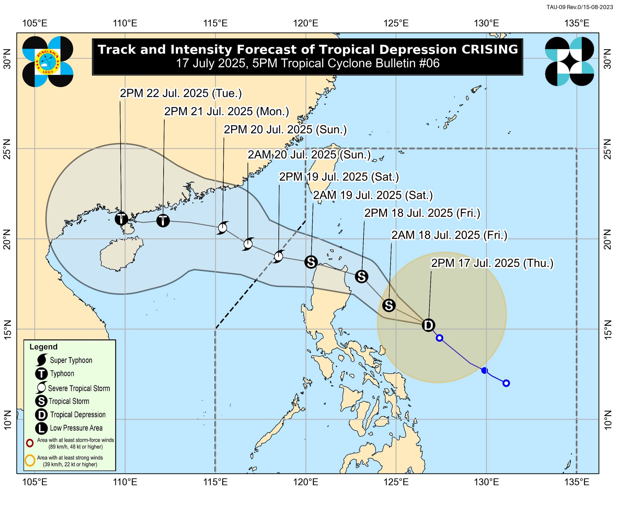
Outlook and Possible Landfall
Crising is expected to move northwestward and may make landfall in mainland Cagayan by Friday evening. It will then cross the northern tip of Luzon and could exit the Philippine Area of Responsibility (PAR) by Saturday afternoon, July 19. PAGASA projects it will strengthen into a Tropical Storm tonight or early tomorrow, and possibly a Severe Tropical Storm before exiting.
Public Advisory
PAGASA urges residents in affected areas to remain vigilant, follow evacuation orders, and monitor updates from local government units and weather authorities. Hazard-prone areas—especially those vulnerable to landslides, floods, and storm surges—are advised to take immediate safety precautions.
The next bulletin on Crising will be issued at 11:00 PM today. For localized weather updates, residents are encouraged to follow announcements from PAGASA’s regional services and disaster management offices.