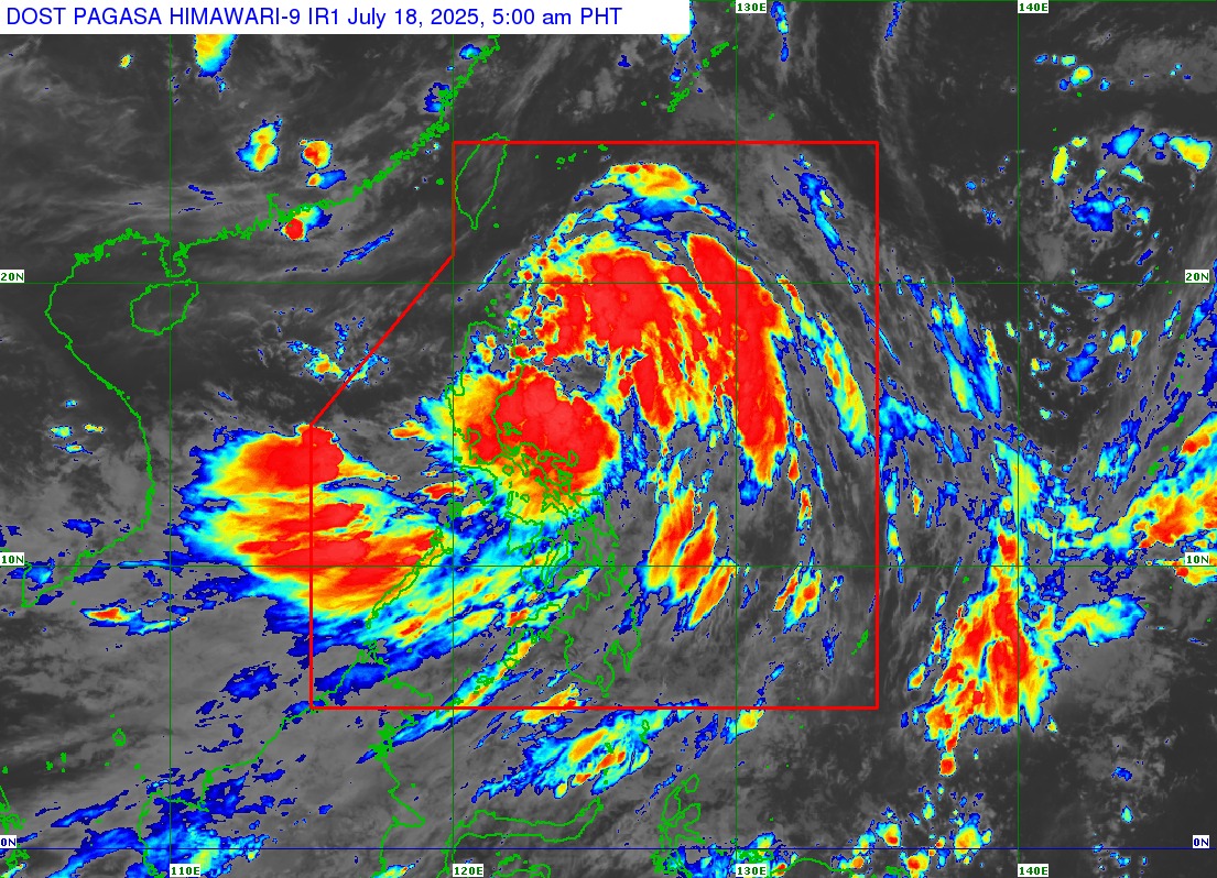
Crising now packs maximum sustained winds of 65 km/h near the center and gusts of up to 80 km/h. It is moving northwestward at a speed of 20 km/h with a central pressure of 996 hPa. Strong to gale-force winds extend outward up to 500 km from the storm’s center.
Storm Signals Raised
PAGASA has raised Tropical Cyclone Wind Signal (TCWS) No. 2 over several areas in Northern and Northeastern Luzon, where gale-force winds (62–88 km/h) may pose minor to moderate threats to life and property. Affected provinces include Batanes, Cagayan including Babuyan Islands, the northern and eastern parts of Isabela, Ilocos Norte, and parts of Apayao, Abra, Kalinga, and Ilocos Sur.
TCWS No. 1 is hoisted over the rest of Isabela, Quirino, Nueva Vizcaya, and large parts of Cordillera, Ilocos Sur, Pangasinan, Aurora, Camarines Norte, Catanduanes, and Camarines Sur. These areas may experience strong winds (39–61 km/h) within the next 36 hours, with minimal to minor damage possible.
Heavy Rainfall and Flooding Threats
PAGASA has also warned of heavy rainfall due to both the tropical storm and the enhanced Southwest Monsoon (Habagat). Affected regions today include parts of Southern Luzon, Visayas, and Mindanao, particularly coastal and mountainous areas.
Residents in flood-prone and landslide-prone areas are strongly advised to take precautionary measures and heed the warnings and evacuation instructions of their local disaster response units.
Storm Surge Risk
A storm surge warning remains in effect, with 1.0 to 2.0 meter surges expected over low-lying and coastal areas of Cagayan, including Babuyan Islands, Isabela, Ilocos Norte, and Ilocos Sur. Coastal residents are urged to be vigilant and to prepare for possible inundation.
Sea Travel Disruptions
A gale warning is in effect for the northern seaboards of Northern Luzon, with sea conditions forecast to be very rough, reaching up to 5.0 meters in Batanes. Up to 4.0-meter waves are also expected around Ilocos Norte, Cagayan, and Babuyan Islands. PAGASA advises all mariners, especially those with small vessels or inexperienced crews, to avoid sea travel until conditions improve.
Expected Track and Landfall
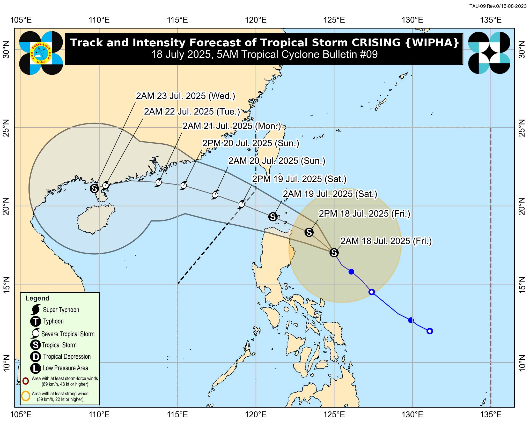
Tropical Storm Crising is forecast to make landfall over mainland Cagayan or Babuyan Islands this afternoon or evening. It is expected to traverse Extreme Northern Luzon and exit the Philippine Area of Responsibility (PAR) by Saturday afternoon. Further intensification into a Severe Tropical Storm is possible by tomorrow.
Public Advisory
PAGASA urges the public and disaster risk reduction authorities to take all necessary measures to safeguard life and property. Communities in vulnerable areas should remain alert, monitor updates, and be ready for evacuation if necessary.
The next bulletin will be issued at 8:00 AM today.
For the latest weather updates, visit www.pagasa.dost.gov.ph or follow PAGASA on social media.