According to the Central Weather Administration (CWA), as of 4:15 AM on July 7, Typhoon Danas continues to impact Taiwan with strong winds and heavy rainfall. The typhoon remains a significant weather system as it moves northeast and gradually shifts northward.
Current Position and Movement
-
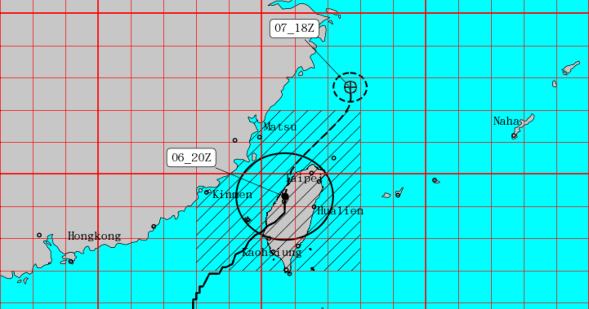
Center Location (as of 062000Z): 24.3°N, 120.7°E
-
Movement: Northeast, turning north
-
Speed: 17 km/h, slowing down to 9 km/h over the next 24 hours
Intensity
-
Minimum Surface Pressure: 960 hPa
-
Maximum Sustained Winds Near Center: 38 meters per second (approx. 137 km/h)
-
Maximum Gusts: 48 meters per second (approx. 173 km/h)
Wind Radius
-
Winds ≥15 m/s: Average radius of 150 km
-
NW quadrant: 140 km
-
NE quadrant: 160 km
-
SW quadrant: 140 km
-
SE quadrant: 160 km
-
-
Winds ≥25 m/s: Radius of 50 km in all quadrants
Forecast Movement
-
Forecast Position by 6:00 PM (071800Z): 27.7°N, 122.7°E
Advisory
Typhoon Danas is expected to continue bringing strong winds and intense rainfall to northern and eastern Taiwan through the day. Residents, particularly in areas prone to flooding, landslides, or coastal hazards, are advised to stay alert and follow safety instructions issued by local authorities.
The CWA urges the public to avoid unnecessary travel and to stay updated with the latest weather bulletins as the typhoon progresses.