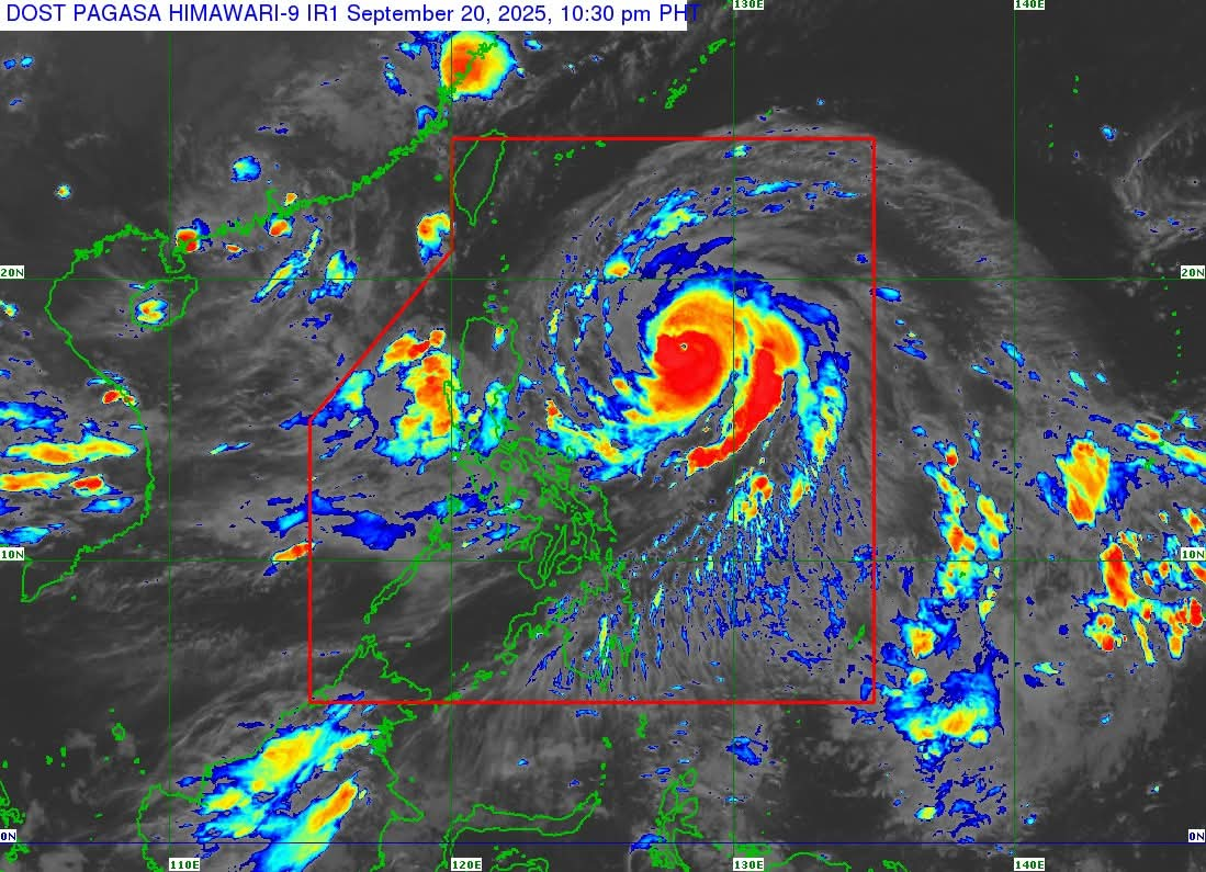
September 20, 2025 – 11:00 PM – Typhoon Nando (international name: Ragasa) has intensified as it continues its northwestward path across the Philippine Sea, according to the latest advisory from PAGASA.
At 10:00 p.m., the storm’s center was estimated to be about 710 km east of Echague, Isabela, or 695 km east of Tuguegarao City, Cagayan. Nando is currently packing maximum sustained winds of 155 km/h, gusts of up to 190 km/h, and a central pressure of 950 hPa, while moving northwest at 15 km/h. Typhoon-force winds extend outward up to 530 km from its center.
Tropical Cyclone Wind Signals
Signal No. 1 has been raised over several provinces in Northern and Central Luzon, including Batanes, Cagayan (including Babuyan Islands), Isabela, Quirino, Apayao, Kalinga, Abra, Mountain Province, Ifugao, Benguet, Nueva Vizcaya, Ilocos Norte, Ilocos Sur, La Union, northern and central Aurora, northern Nueva Ecija, parts of Pangasinan, and portions of Catanduanes. These areas may experience strong winds within the next 36 hours, bringing minimal to minor threats to life and property.
PAGASA noted that the highest possible warning signal that could be raised during Nando’s passage is Signal No. 5.
Other Hazards
-
Rainfall: Heavy rains are expected due to the combined effects of Typhoon Nando and the Southwest Monsoon. Residents are urged to monitor rainfall advisories and local weather warnings.
-
Winds: Enhanced winds are likely in coastal and upland areas. Strong gusts are expected across Bicol Region, Eastern Visayas, and Caraga today, extending to Metro Manila, CALABARZON, Central Luzon, Visayas, and parts of Mindanao in the coming days.
-
Coastal Waters: A gale warning remains in effect for the northern and eastern seaboards of Northern Luzon. Seas may reach up to 11 meters high in some areas, making sea travel extremely dangerous. Small boats and motorbancas are advised not to venture out.
-
Storm Surge: PAGASA warned of a life-threatening storm surge exceeding 3 meters over coastal communities in Batanes, Cagayan including Babuyan Islands, Ilocos Norte, and Ilocos Sur within the next 48 hours.
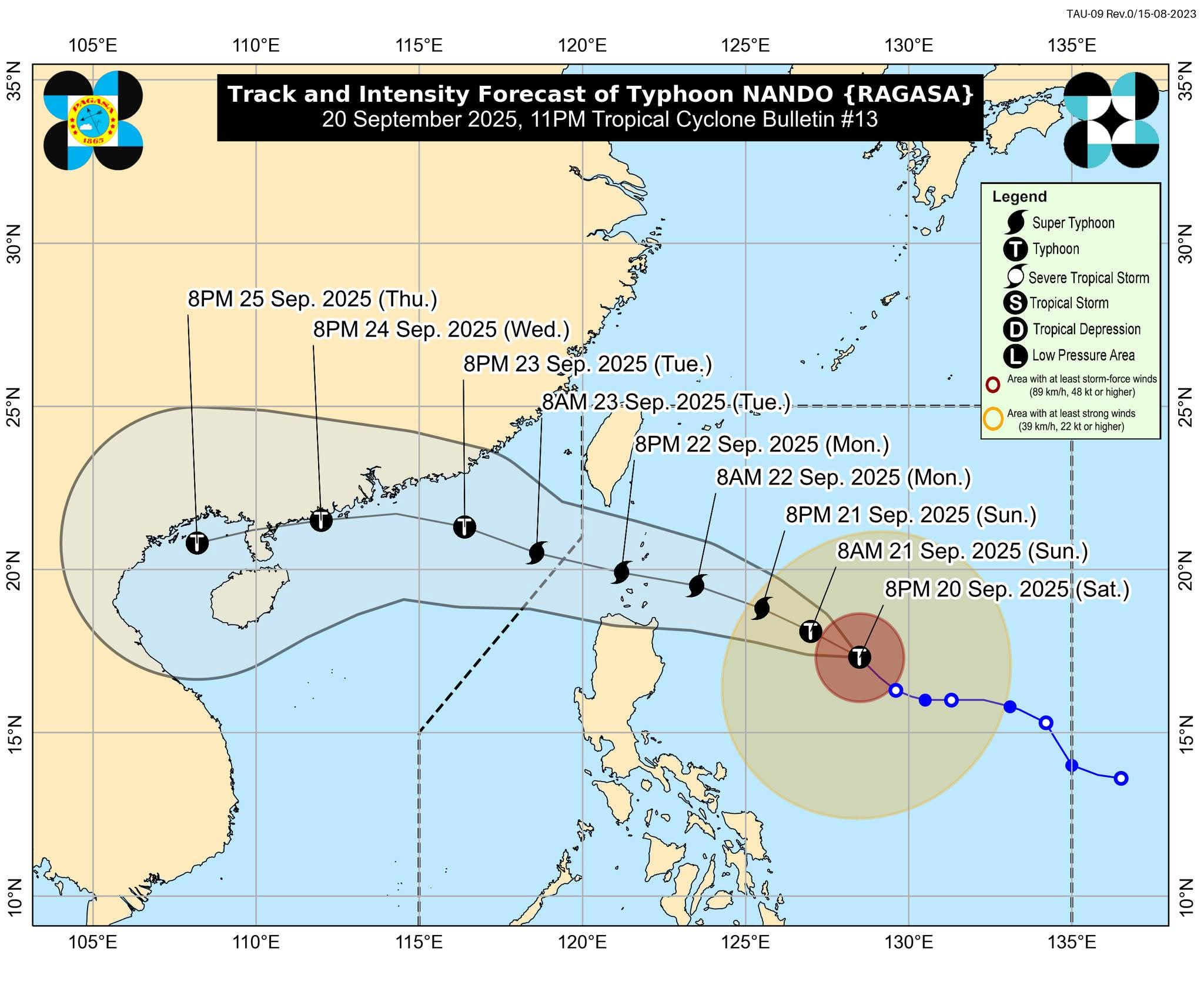
Track and Intensity
Forecast models indicate that Nando will veer west-northwestward toward Extreme Northern Luzon. The system may pass close to or make landfall over Batanes or Babuyan Islands between Monday afternoon and evening. It is expected to leave the Philippine Area of Responsibility (PAR) by Tuesday morning.
PAGASA also warned that Nando could strengthen further and may reach the super typhoon category before nearing Extreme Northern Luzon.
Advisory for Southern Taiwan
Meteorological agencies also caution that southern Taiwan may experience strong winds, heavy rainfall, and coastal hazards as Nando approaches the Batanes-Babuyan area. Localized flooding, storm surges, and disruptions to sea and air travel are possible. Residents of southern Taiwan are advised to closely monitor bulletins from the Central Weather Administration (CWA) and prepare for potential severe weather conditions.
Advisory to the Public
Authorities urged residents in both the Philippines and Taiwan, especially those in high-risk and low-lying areas, to take precautionary measures, follow evacuation orders if necessary, and remain vigilant for updates. Fisherfolk and mariners were strongly advised to stay in port until conditions improve.
The next official advisory will be issued at 5:00 AM on September 21.
Source: DOST-PAGASA