TAIPEI — Typhoon Wipha, the sixth typhoon to develop this year, officially formed at 2:00 a.m. today, prompting the National Meteorological Administration to issue a marine typhoon warning by 11:30 a.m.
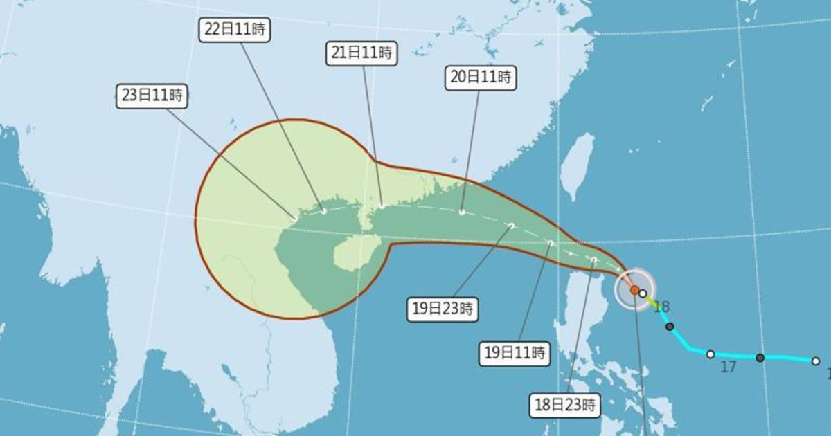
According to Xie Peiyun, chief engineer at the Central Meteorological Administration’s Forecast Center, Wipha is currently positioned over the eastern waters off Luzon Island in the Philippines, approximately 550 kilometers from Taiwan.
Xie noted that the typhoon is projected to move in a northwest direction between today and tomorrow, likely passing through the southern part of the Bashi Channel. “Although the system will not make landfall in Taiwan, it will come close enough to influence the sea conditions, particularly to the south of the island,” she said.
Forecast models show that the storm’s outer bands may extend into Taiwan’s coastal monitoring zones, bringing increased wind and wave activity. While the core of the typhoon is expected to remain at sea, authorities are closely monitoring any westward deviation that could bring stronger impacts.
Fishermen and vessels operating in southern waters have been urged to exercise caution, as the storm could intensify and expand its radius as it moves.
The Central Weather Administration continues to track Typhoon Wipha’s movement and intensity and will issue updates as needed. The public is advised to stay alert for any further bulletins, particularly those living or working in coastal and maritime areas.