Taipei — The Central Weather Administration (CWA) announced that a broad low-pressure belt has formed over the South China Sea, east of the Philippines, creating favorable conditions for tropical cyclone development. Officials said they are closely monitoring these systems and their potential impact on Taiwan, noting that “the latter half of the typhoon season has officially begun.”
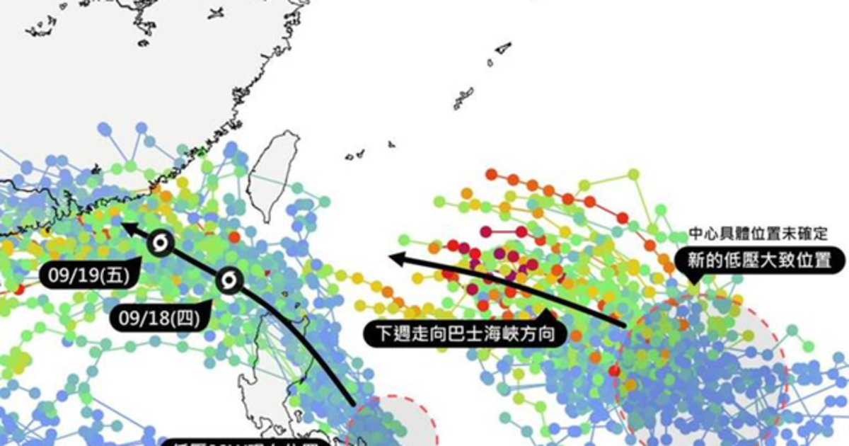
According to the “Taiwan Typhoon Forum – Weather Emergency,” two low-pressure zones are currently active east of the Philippines. One of them, identified as “99W,” is approaching the eastern Philippine coast and is expected to make landfall tomorrow (Sept. 17). While it is unlikely to strike Taiwan directly, its outer circulation may bring rainfall to southern and eastern regions starting Thursday (Sept. 18).
Farther east, another low-pressure system near Guam remains disorganized, with a loose cloud formation and an unstable center. Meteorologists say that while its exact path cannot yet be determined, it appears to be tracking westward and has the potential to intensify.
Weather analysts caution that based on current data, the developing system could move through the area between Taiwan and the Bashi Channel in the middle of next week. Whether it will make landfall or simply pass by remains uncertain, but residents and those with outdoor plans are urged to monitor forecasts closely.