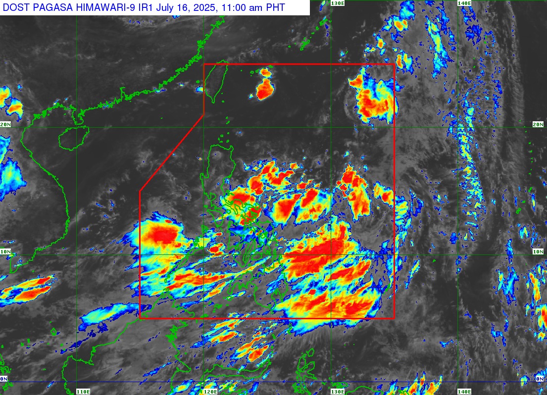
Issued: July 16, 2025 | 11:00 AM
Source: DOST-PAGASA
The low-pressure area east of Catanduanes has intensified into a tropical depression and has been named Tropical Depression Crising, according to PAGASA’s 11:00 AM weather bulletin.
Current Status
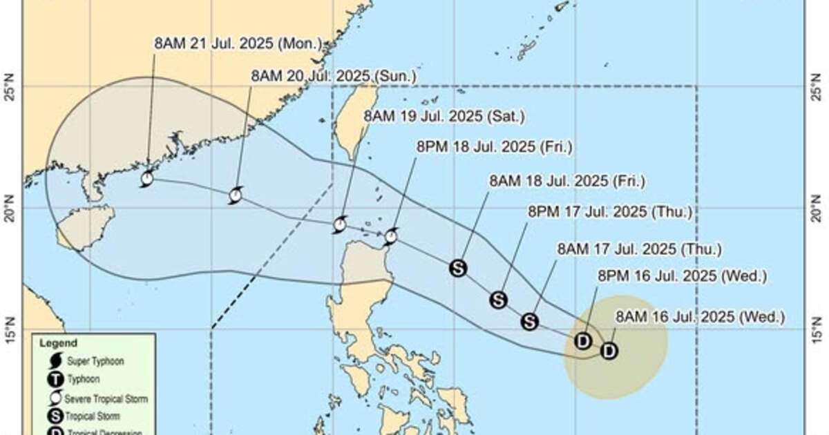
As of 10:00 AM today, the center of Tropical Depression Crising was located approximately 725 kilometers east of Virac, Catanduanes (14.0°N, 130.9°E). The system is currently packing maximum sustained winds of 45 km/h near the center with gusts of up to 55 km/h and a central pressure of 1004 hPa. It is moving westward at 35 km/h.
Strong winds extend outward up to 280 kilometers from the center, but no Tropical Cyclone Wind Signals (TCWS) have been raised at this time.
Rainfall and Wind Hazards
Crising, combined with the prevailing southwest monsoon, is expected to enhance rainfall and wind activity in parts of the country over the next few days.
Heavy Rainfall:
For detailed rainfall projections, refer to Weather Advisory No. 4 issued at 11:00 AM. The public is urged to stay alert for possible floods and landslides, especially in low-lying and mountainous areas.
Strong to Gale-Force Winds:
The southwest monsoon will bring gusty conditions to several regions:
-
Today (July 16): Palawan, Camiguin, Southern Leyte, Surigao del Norte, Dinagat Islands
-
Tomorrow (July 17): Quezon, Bicol Region, MIMAROPA, Visayas, Camiguin, Zamboanga del Norte, Surigao del Norte, Dinagat Islands
-
Friday (July 18): Quezon, Bicol Region, MIMAROPA, Visayas, Camiguin, Zamboanga del Norte, Surigao del Norte, Dinagat Islands, Davao Region
Coastal Waters
Sea conditions will range from moderate to rough, particularly along the following areas:
-
Up to 2.5 meters: Palawan, Negros Oriental, Zamboanga del Norte
-
Up to 2.0 meters: Occidental Mindoro, Antique, Negros Occidental, Bohol, Camiguin, Surigao del Norte, Dinagat Islands, and Davao Region
Small vessels such as motorbancas are advised to exercise caution and avoid sailing in risky conditions.
Forecast Track and Intensity
Crising is projected to move generally west-northwestward to northwestward in the coming days. By Friday evening (July 18), it may pass close to or make landfall over the Babuyan Islands, with the possibility of a shift in track toward mainland Cagayan.
-
It is expected to intensify into a Tropical Storm by Thursday (July 17).
-
Further strengthening to a Severe Tropical Storm is likely by Friday.
-
Intensification into a Typhoon is not ruled out before nearing Northern Luzon.
Public Advisory
PAGASA advises the public and disaster risk reduction and management councils to monitor developments and take precautionary measures. Residents in hazard-prone areas should heed local government advisories and prepare for potential evacuations.
The next tropical cyclone bulletin will be released at 5:00 PM today.
Stay updated through PAGASA and local government units for the latest weather advisories.