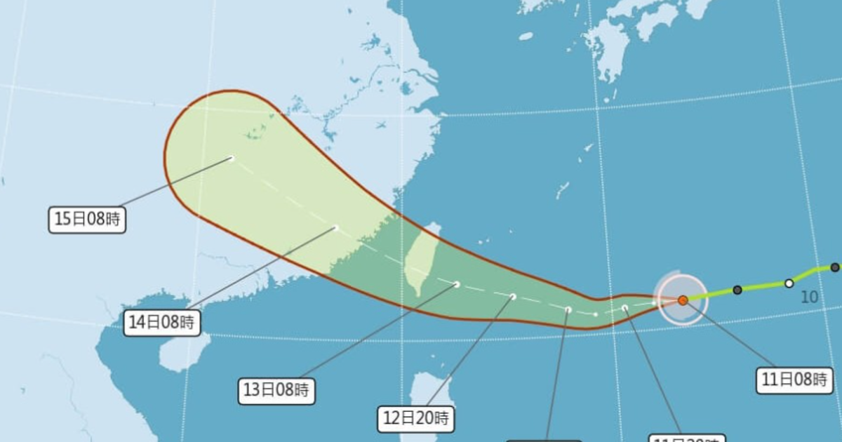
August 11, 2025 – The Central Weather Administration (CWA) has announced that Typhoon Podul is on course to make landfall along Taiwan’s east coast on Wednesday, with its impact expected to be felt nationwide through Thursday.
Ahead of the storm, Greater Taipei could experience sweltering temperatures reaching 36°C on Monday, while other parts of the island may see highs of up to 35°C. Brief afternoon showers are forecast in western Taiwan, Yilan, and the eastern mountain ranges, with other regions enjoying partly cloudy to sunny skies, according to the Central News Agency.
As of Monday, Typhoon Podul was located approximately 1,410 kilometers east of Taiwan, moving westward at a speed of 23 kilometers per hour. The CWA noted that the system may intensify later in the day, with the possibility of a sea warning being issued by Tuesday.
The weather bureau predicts scattered showers or thunderstorms in northern and eastern Taiwan on Wednesday, while central and southern areas may see occasional light rain. Heavy downpours are possible in parts of the southern mountains.
By Thursday afternoon, the typhoon is expected to move away from the island, leading to an easing of rainfall. However, sporadic showers may persist in central, southern, and southeastern Taiwan, with other areas likely to remain mostly cloudy.
Looking ahead, from Friday through the weekend, brief rain is anticipated in the eastern and southeastern regions, while afternoon thunderstorms could develop elsewhere across the island.